Mean State
Download Data |
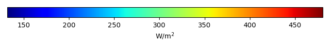
Period Mean (original grids) [W/m2] |
Model Period Mean (intersection) [W/m2] |
Benchmark Period Mean (intersection) [W/m2] |
Model Period Mean (complement) [W/m2] |
Benchmark Period Mean (complement) [W/m2] |
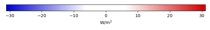
Bias [W/m2] |
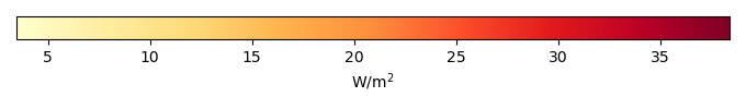
RMSE [W/m2] |
Phase Shift [months] |
Bias Score [1] |
RMSE Score [1] |
Seasonal Cycle Score [1] |
Spatial Distribution Score [1] |
Overall Score [1] |
|||
|---|---|---|---|---|---|---|---|---|---|---|---|---|---|---|---|---|
| Benchmark | [-] | 399. | ||||||||||||||
| BGCv1-BDRD | [-] | 378. | 378. | 380. | 410. | -2.73 | 17.2 | 0.683 | 0.682 | 0.679 | 0.929 | 0.996 | 0.793 | |||
| BGCv1-LNDATM | [-] | 381. | 381. | 380. | 410. | 0.207 | 15.5 | 0.598 | 0.697 | 0.711 | 0.936 | 0.998 | 0.810 | |||
| I20TRGSWCNP | [-] | 378. | 378. | 377. | 409. | 2.90 | 11.6 | 0.471 | 0.756 | 0.788 | 0.946 | 1.00 | 0.856 | |||
| I20TRWCCNP | [-] | 369. | 369. | 377. | 409. | -5.21 | 16.4 | 0.677 | 0.706 | 0.723 | 0.926 | 0.997 | 0.815 | |||
| v2.LR.BGC-LNDATM.CONTRL | [-] | 375. | 375. | 377. | 409. | 0.0516 | 15.3 | 0.512 | 0.718 | 0.748 | 0.946 | 0.998 | 0.832 |
Download Data |
Period Mean (original grids) [W/m2] |
Model Period Mean (intersection) [W/m2] |
Benchmark Period Mean (intersection) [W/m2] |
Model Period Mean (complement) [W/m2] |
Benchmark Period Mean (complement) [W/m2] |
Bias [W/m2] |
RMSE [W/m2] |
Phase Shift [months] |
Bias Score [1] |
RMSE Score [1] |
Seasonal Cycle Score [1] |
Spatial Distribution Score [1] |
Overall Score [1] |
|||
|---|---|---|---|---|---|---|---|---|---|---|---|---|---|---|---|---|
| Benchmark | [-] | 465. | ||||||||||||||
| BGCv1-BDRD | [-] | 461. | 461. | 465. | 462. | -4.66 | 15.6 | 0.790 | 0.626 | 0.598 | 0.925 | 0.978 | 0.745 | |||
| BGCv1-LNDATM | [-] | 460. | 460. | 465. | 462. | -5.47 | 12.9 | 0.679 | 0.648 | 0.670 | 0.930 | 0.964 | 0.776 | |||
| I20TRGSWCNP | [-] | 475. | 475. | 465. | 462. | 9.84 | 14.2 | 0.601 | 0.577 | 0.708 | 0.942 | 1.00 | 0.787 | |||
| I20TRWCCNP | [-] | 461. | 461. | 465. | 462. | -3.77 | 16.7 | 0.979 | 0.630 | 0.586 | 0.909 | 0.998 | 0.742 | |||
| v2.LR.BGC-LNDATM.CONTRL | [-] | 462. | 462. | 465. | 462. | -3.25 | 12.2 | 0.580 | 0.656 | 0.695 | 0.944 | 0.995 | 0.797 |
Download Data |
Period Mean (original grids) [W/m2] |
Model Period Mean (intersection) [W/m2] |
Benchmark Period Mean (intersection) [W/m2] |
Model Period Mean (complement) [W/m2] |
Benchmark Period Mean (complement) [W/m2] |
Bias [W/m2] |
RMSE [W/m2] |
Phase Shift [months] |
Bias Score [1] |
RMSE Score [1] |
Seasonal Cycle Score [1] |
Spatial Distribution Score [1] |
Overall Score [1] |
|||
|---|---|---|---|---|---|---|---|---|---|---|---|---|---|---|---|---|
| Benchmark | [-] | 443. | ||||||||||||||
| BGCv1-BDRD | [-] | 441. | 442. | 443. | 440. | -1.62 | 14.7 | 1.43 | 0.630 | 0.576 | 0.811 | 0.983 | 0.715 | |||
| BGCv1-LNDATM | [-] | 440. | 440. | 443. | 440. | -3.31 | 14.3 | 1.14 | 0.622 | 0.580 | 0.845 | 0.987 | 0.723 | |||
| I20TRGSWCNP | [-] | 448. | 448. | 443. | 441. | 4.43 | 12.6 | 1.13 | 0.627 | 0.629 | 0.842 | 0.998 | 0.745 | |||
| I20TRWCCNP | [-] | 434. | 434. | 443. | 441. | -8.11 | 14.9 | 1.32 | 0.567 | 0.632 | 0.812 | 0.999 | 0.728 | |||
| v2.LR.BGC-LNDATM.CONTRL | [-] | 436. | 436. | 443. | 441. | -6.31 | 14.7 | 1.20 | 0.586 | 0.611 | 0.837 | 0.988 | 0.726 |
Temporally integrated period mean